-
Category Utilities
-
Size 99.5 MB
DatuFly is a professional imagery app for surveying, 3D modelling and construction industries, providing simple drone flight planning and automated, high resolution photo-shooting for mapping, 3D objects modelling, measurement and construction site management. DatuFly features an intuitive user interface for creating missions that automatically guide the drone to capture optimized aerial images, in order to generate 2D and 3D maps, using Surveying and Construction industry best practices. Features and benefits:- Simple and intuitive user interface - Designed specifically for tablets- Fully automated operation, from job type optimization to automated photo shooting- Vertical and Oblique photo shooting and mission planning- Multiple batterys support per project (exchange battery & resume mission)- Surveyor and Construction oriented workflow- Multi projects support- Pre-flight checks and calibrations- Harmless field surveying, keeping the surveyors and operators safe - Drone safety wizards- Analytics- Mission planning projections- Real time mission data and imagery stream- Emergency landing and RTH- Offline flight capabilities- Chinese language support- Aligned with DatuSurvey imagery best practicesDatuFly is compatible with the DJI Phantom 4 and 4 Pro, Phantom 3 Professional, Inspire 1 Pro and Matrice 600
| # | Similar Apps |
|---|---|
| 1 | Map Pilot for DJI |
| 2 | FPV Camera for DJI |
| 3 | Litchi for DJI Mavic / Phantom / Inspire / Spark |
| 4 | Photographer's Ephemeris 3D |
| 5 | FlyToDiscover - Bebop |
DatuFly alternatives
Flight Plan for DJI Drones
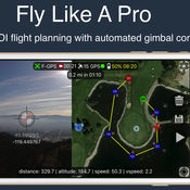
Fly like a pro - Create flight plans quickly that keep the camera focused on your subject with smooth transitions and perfect framing. With autonomous flight plans you can accomplish shots far to difficult to fly manually. Crosshairs display lat/lng targetFollow-me with auto gimbal controlFull ground stationVariable width FPV/map viewGesture camera controlInstructions:http://flightplan.beyondthecube.ca/Demo Videos:https://www.youtube.com/watch?v=FbO_dfTj-PY&list=PLa6UXqRipoPoss6G69VPzQtf89GVg3jnM
-
size 113 MB
Map Pilot for DJI
Map Pilot helps you create and fly the optimal flight path to create great maps using the Maps Made Easy map processing service. Collecting great data to create high resolution aerial maps with your DJI flying camera is just a few clicks away. Features: Terrain Awareness Multi-Pass Linear Mission Planning Multi-Flight Coordination Multi-Battery Management Automatic, Shutter Priority and Manual Exposure Modes Basemap Caching for Offline Operations Connectionless Camera Triggering External Map Data and Markers via MapBox Terrain Aware Image Footprint Display Save/Edit Missions Refly Saved Missions View 3D logs on-device with Google Earth Import KML via Email or AirDrop Export KML, log files, and Flights file via Email or AirDrop Flight Log review Built-in Simulator for testing HealthyDrones upload from Log File Manager RAW imaging available via In App Purchase Fullest Possible Use of Each Battery Appropriate Camera Triggering Overlap Management Speed Management Automatic Takeoff and Landing Live Video Preview (large and small) Signal Quality Warning Line of Sight Indicator Automatically Captures Elevation Reference Image (Ground Image) Natural Landing Assistance Live Map ViewCompatible with iOS 8, iOS 9, and iOS 10.Supported Aircraft: Inspire 2 w/X4S and X5S Phantom 4 Pro Phantom 4 Advanced Phantom 4 Mavic Pro Phantom 3 Professional Phantom 3 Advanced Phantom 3 Standard Inspire 1 Inspire 1 Pro Matrice M100 Matrice M200 Matrice M600
-
size 41.2 MB
Airspace for DJI
Airspace is a free iOS app that allows you to participate in Airspaces created with Autopilot. Airspace allows multiple devices to share telemetry in real-time, including both location and altitude information. There are many possible use cases for Airspace, including but not limited to:- Using the location of an iPhone as the Focus Subject where the iPhone is attached to an athlete- Using the location of an iPhone as the Follow Leader on a wifi-only iPad- Using the barometric altitude of an iPhone as the Altitude Reference on an older iPad without a barometer- Using the location of an aircraft as the Focus Subject for a second aircraft (chase plane)- Using the location of an aircraft as the Follow Leader for a second aircraft (formation flying)
-
size 26.5 MB
Pix4Dcapture
Pix4Dcapture turns your consumer drone into a professional mapping tool. A free companion of Pix4D software, Pix4Dcapture is the perfect tool to automatically capture image data for optimal 3D models and 2D maps. Discover our cloud and desktop 3D mapping and modeling solutions on our website.
-
size 137 MB
HD Sync
Is your drone healthy? Or is it about to surprise you on your next flight? In order to view your flight details - please visit the site directly.
-
size 10.9 MB
More Information About alternatives
Map Pilot for DJI
Map Pilot helps you create and fly the optimal flight path to create great maps using the Maps Made Easy map processing service. Collecting great data to create high resolution aerial maps with your DJI flying camera is just a few clicks away. Features: Terrain Awareness Multi-Pass Linear Mission Planning Multi-Flight Coordination Multi-Battery Management Automatic, Shutter Priority and Manual Exposure Modes Basemap Caching for Offline Operations Connectionless Camera Triggering External Map Data and Markers via MapBox Terrain Aware Image Footprint Display Save/Edit Missions Refly Saved Missions View 3D logs on-device with Google Earth Import KML via Email or AirDrop Export KML, log files, and Flights file via Email or AirDrop Flight Log review Built-in Simulator for testing HealthyDrones upload from Log File Manager RAW imaging available via In App Purchase Fullest Possible Use of Each Battery Appropriate Camera Triggering Overlap Management Speed Management Automatic Takeoff and Landing Live Video Preview (large and small) Signal Quality Warning Line of Sight Indicator Automatically Captures Elevation Reference Image (Ground Image) Natural Landing Assistance Live Map ViewCompatible with iOS 8, iOS 9, and iOS 10.Supported Aircraft: Inspire 2 w/X4S and X5S Phantom 4 Pro Phantom 4 Advanced Phantom 4 Mavic Pro Phantom 3 Professional Phantom 3 Advanced Phantom 3 Standard Inspire 1 Inspire 1 Pro Matrice M100 Matrice M200 Matrice M600
-
size 41.2 MB
-
version 2.6.4
FPV Camera for DJI
Complete new flying and shooting dimension for DJI drones with innovative features. Compatible DJI platform: Mavic Pro, Phantom 3/4, Inspire 1/2, Matrice 100/600 Compatible DJI camera: Zenmuse X3, X5, X5R, Z3, Z30, X4S, X5S Compatible iOS devices: iPad Air/Air 2/Pro, iPad mini 2/3/4, iPhone 5s/6/6+/6s/6s+/7/7+/SE Both app and support are in English onlyCamera Navigation Map consists of accurate Google Map and Pilot Wand Up-to 12 custom telemetry data with either vertical or horizontal layout Unique and creative Touchless UI allows pilots to change camera settings and control the app without touching screen Real-time battery consumption meter - mAh/km or mAh/mi Custom Warning message Screen RecorderMission Planner Mission Planner is an intelligent ground station with unique TERRAIN ELEVATION to program & save autonomous WAYPOINT, ORBIT and PANORAMA flights for superior footage. You can delete, import and export flights logs to CSV file for third-party application (such as DashWare) for further manipulation.
-
rating 4.2
-
size 105 MB
-
version 3.5
Litchi for DJI Mavic / Phantom / Inspire / Spark
Unlock the full potential of your DJI Mavic / Phantom / Inspire / Spark with Litchi, everyones favorite autonomous flight app. Compatible with: DJI Mavic Pro, Phantom 4 Normal/Advanced/Pro, Phantom 3 Standard/4K/Advanced/Professional, Inspire 1 X3/Z3/Pro/RAW, Inspire 2, Spark. Purchase Litchi today and get a free one-month subscription for Airdata UAVs HD 360 Pro plan, exclusive to Litchi pilots, refer to https://flylitchi.com/airdata for more infoFeature highlights:- Virtual Reality mode compatible with most mobile VR goggles such as Freefly VR, Durovis, Homido, Cardboard etc- Move the gimbal/aircraft with your head in VR mode- Track mode: the aircraft can track any object you select on the video preview, you can also Orbit around the tracked object or have the aircraft autonomously follow the subject- Panorama mode: easily shoot 360 horizontal and spherical panoramas- Focus mode: easily keep focus on a subject while flying your aircraft- Orbit mode with advanced settings and real time controls- Ability to pre-plan Waypoint missions without being connected to the aircraft- Waypoint missions will continue even when signal is lost- Ability to plan waypoint missions on a desktop PC/Mac at https://flylitchi.com/hub, missions can then be synced and executed with Litchi- Automatic mission sync across all your devices when logged in to your Litchi account- Draw waypoint missions with the pen tool- Setup classic Waypoint missions as well as Cable Cams, Selfies and more- Waypoint mode supports multiple Points of Interest- Customizable Bezier curves in Waypoint mode for smoother videos- 6 different waypoint actions (Stay for / Take Photo / Start Recording / Stop Recording / Rotate Aircraft / Tilt Camera)- Automatic gimbal control (Focus POI and Interpolate)- Take manual control of the aircraft during the mission to play/replay the mission on the fly including gimbal movements- Use the Panorama preset to easily shoot a horizontal panorama at waypoints- Custom RC keys functions allowing you to create missions as you fly them and more- Load and Save your missions- Livestream your drones video feed to Facebook- Stream the video feed to a nearby device running the Litchi Vue app (for USB-based drones)- Record your iOS device screen at the tap of a button- Human readable flight logs, can be automatically uploaded to Airdata UAV- Voice feedback for important warnings- All camera settings are included- Automatic video recordingVisit our website for more information: https://flylitchi.com
-
rating 4.42856
Photographer's Ephemeris 3D
3D Sun, Moon and Night Photography Planning For Outdoor Photographers. The Photographers Ephemeris 3D (TPE 3D) is a unique natural light visualization tool for outdoor and landscape photographers shooting in varied terrain. Key features includes:- 3D topographic maps with simple navigation options- Sun, moon and galactic centre continuous timeline showing key rise, set and transit events- Full search capability to find your location (or enter decimal or DMS coordinates directly)- Automated playback to watch a realtime or faster-than-realtime simulation of the light- Flying mode for quick movement around a scene- Enhanced mode for maximum topography and shadow detail- Symbolic represetation of the Milky Way in Flying mode- High resolution Milky Way and stars in Enhanced mode- Direct elevation control for the 3D model camera- Camera pitch and bearing indicators- Moon phases are rendered accurately in the 3D scene- Zoom in/out to equivalent 35mm focal length in enhanced mode- Daily and annual events lists- Shared location database with TPE- Navigation and Artificial Highlights lighting modes- Support for multiple map pins- User settings for controlling scene complexityIf you like to plan your natural light photography to capture the photo opportunities others miss, TPE 3D is a must-have tool Note:- This app is CPU and graphics intensive: modern device models provide the best user experience and highest resolution data- Not recommended for users who only shoot in flat terrain- Satellite maps are not included- Building are not shown in 3D- Max elevation data resolution is 1 arcsecond (approximately 30m/33yards)- Requires an internet connection- Does not currently provide simulation of lighting during solar and lunar eclipses- Topographic data is available only between 83N and 83S: data may contain artifacts and errors- Availability of map types is subject to change, due to 3rd party map service availability, terms or conditions
-
rating 4.22222
-
size 74.9 MB
-
version 1.2
FlyToDiscover - Bebop
Fly to Discover allow you to control your Parrot Bebop, Bebop 2, FTD300X and Super300 thanks to fabulous functions such as:Main features:- Now with SKY CONTROLLER 2 support - PANORAMA create fabulous 360 picture with your Bebop- MULTIMEDIA for managing your bebop memory- VOICE CONTROL to control your bebop with your voice- Translated in English, Italian, Portuguese, French, Spanish, German and Romanian- Integrated 2D simulator to fly even when the weather does not allow it. You can familiarize yourself with all the functions of FTD without reading boring manual and without having to connect your Bebop.- Exclusive compatibility with Apple Watch Control your Bebop with your wrist - Control via analog sticks for precise driving experience at all times- Simple and intuitive graphics, cockpit customizable pull-down menus and draggable items- Compatible with Parrot SkyController and SkyController 2- Magnetometer calibration tool for Bebop and SkyController- Detailed picture settings menu for optimum results- Dynamic charts in real time: battery, altitude, speed and distance- Photo mode (DNG, JPEG 4: 3, 16: 9, Fisheye), Video mode, Time Lapse, Photo Panoramic 360- Map mode with FPV box- Localization Bebop compared to the pilot (Radar)- Follow Me Mode (Bebop follow you at a distance and height adjustable) with block angle (Bebop follow you at the same angle)- Orbit Me (Bebop will make a circle around you at a distance and adjustable speed)- Flight time and time of video recording- Return to home in case of radio signal loss or pressing appropriate button- Selection of piloting modes: Mode 1, Mode 2, Mode 3, Mode 4- Selection of flight parameters: maximum inclination, tilt speed, maximum vertical speed, maximum rotation speed- Selection of banked turn- Warning messages with vibration (optional)- Selection of flight limits: max altitude and max distance- Pause time before RTH- RTH location: takeoff or pilot- Network settings: change your Bebop name, changing country, auto or manual band (2.4GHz-5GHz), wi-fi channel with free channels and setting wi-fi password to make sure your Bebop- Function VR with deactivation video stabilization of Pitch and Roll for a VR experience even more real- Band, channel and name selection of SkyController- Compatible with iOS MFi Bluetooth Controller: Nimbus, Mad Catz, Moga rebel and others- Move the framing of Bebop dragging two fingers on the screen- Automatic recording of all flights, and section to review all the details- Function Find my drone, in case you lost your drone you can easily find it again with this function- Successfully Tested with wi-fi extender
-
size 79.3 MB
-
version 1.5.0
