-
Category Navigation
-
Size 8.1 MB
The compass that guides you to every place on earthNo internet connection neededSmall download sizeNot everybody needs a big navigation systemNot everybody wants a dominant voice to keep him on trackBut if you exit a pub after one pint too much if you are riding your mountain bike aside of the roads if you are walking through nature if you are on a lake or on the sea without nautic high tech if you are on your camel in the desert then sometimes you need someone to point to the right direction The good news:Thats exactly what BringMeHome does. Just store your favorite places in the waypoint list and you always know which direction you have to take. So let me give you a brief overview shows the direction to any destination in the world Pick any place worldwide from a map or search addresses or points of interest or landmarks displays the distance in m and km as well as in feet and miles and nautic miles (nm) displays the speed in km/h mph and nautic knots displays time and average speed in total AND in motion Share your position on facebook and twitter or by iMessage with other BringMeHome users, who can automatically navigate to you by tapping the message-link All information is available on the iPhone as well as on the Apple watch and the iPad Distance to the destination, the direction and the speed are also shown in the TODAY screen that you can access without unlocking your phone OK, there might be some more stuff but I keep the ball flat (a german figure of speech, which means I dont want to tell you more than you want to know)Happy BringMeHome-ing# Differences of the Full versionThe free version contains all functionality of the full version, but only the first two last waypoints can be used for navigation only the first 5 search results can be used for navigation only the topmost 5 Point of Interest (POI) results can be used for navigation and of course in the full version there are no ads ;-)
BringMeHome - The compass needle to YOUR destination alternatives
Poison Maps - North America
Poison Maps (POIs on Maps) is the ultimate app for finding Points of Interest anywhere in North America. It includes millions of POIs and thousands of miles of routes, all stored on your device for use even when offline. Note that this free version includes most of the categories, but the expansion pack is required for POIs and routes in the food & drink, shops, sport & leisure and driving categories.
-
size 131 MB
WOTA: U-Boat Compass
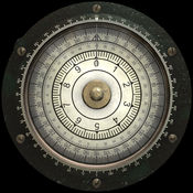
This is a working detailed 3D-Simulation of a U-Boat compass used on German Type VII U-Boats during World War 2.This App uses artwork from the upcoming mobile submarine simulation WOTA: Wolves of the Atlantic and was developed in cooperation with the Technical Museum U 995 of the German Naval Association. In addition, the app comes with a short animated tour detailing the compass installations aboard Type VII submarines. Please dont use this app for critical applications like real world navigation
-
size 353 MB
Compass J.P.J Military GPS
Optimized for iPhone 5,5S , iPhone 6, iPhone 6 Plus. iPhone 6S .6S Plus iPhone SE iPhone 7. Weather Temperature information. Wind Visibility Sunrise,Sunset
-
size 20.8 MB
iAltiVario Lite
Set of instruments for general aviation airplanes, free flight, ultra-light, gliders, hot air balloons on your iPhone and Apple Watch. Includes a real barometric altimeter and variometer for iPhone 6 and later and iPad Air 2 and later. We are working hard on new features, please visit our web site and forum to give us input about your preferences.
-
size 5.6 MB


