-
Category Navigation
-
Rating 2.14286
-
Size 12.9 MB
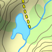
WHAT IS TROUT STREAM GPS?Trout Stream GPS shows you where to park and fish on Americas trout streams. The app is free to download, and maps are available for in-app purchase. FEATURES-Highly detailed fly fishing maps of trout streams in the United States-Displays the location of access points, holes, pools, runs, boat ramps, etc.-Works on the iPhone and iPad-GPS enabled for real-time navigation on the water-Generate driving directions from your current location to a specific waypoint-Add custom waypoints to mark the location of your favorite fishing spots
Trout Stream GPS - Fly Fishing Maps alternatives
Topo Maps US
Download and view topographic maps covering the United States. Topographic maps are useful for recreational activities such as hiking, canoeing, camping, fishing, mountain biking, geocaching, and exploring. Note: Continued use of GPS running in the background can dramatically decrease battery life.
-
rating 5.0
-
size 17.2 MB
i-Boating: Nautical / Marine Charts & Fishing Maps
This App offers access to Marine Charts for USA,Canada,UK/Ireland,Germany,Netherlands/Holland &Europe Rivers (Danube,Drava,Rhein etc). Coverage includes NOAA marine vectorcharts,freshwater lake maps,USACE inland river maps (HD/1ft/3ft bathymetryincluded where available),charts derived from UKHO & CHS data. Sample ChartsSUGARLOAF KEY-KEY WESTPORT RICHEY TAMPA BAY - CLEARWATER HBREAST BAY-WEST BAY FLORIDAST JOSEPH,ST ANDREW BAYSINTRACOASTAL WATERWAY MATECUMBE-GRASSY KEYCHESAPEAKE BAY CAPE CHARLES-NORFOLK HARBORANCLOTE KEYS-CRYSTAL RIVERST JOSEPH SOUNDMIAMI HARBORMinnesota lakes - Kabetogama,Minnetonka,Waconia,Leech,Mille LacsLake Keowee,Jocassee,Hartwell,Greenwood,Lake MurrayMark Twain,Ozarks,Table RockLake St. ClairLake KentuckyKEY WEST-THE MISSISSIPPI RIVERSAN PEDRO CHANNELLAKE MICHIGAN STONY LAKE-POINT BETSIEAPALACHICOLA BAY-CAPE SAN BLASEAST CAPE-MORMON KEYCAPE HENLOPEN-INDIAN RIVERCHESAPEAKE BAY CAPE HENRY-THIMBLE SHOAL LIGHTDULUTH-SUPERIORMONHEGAN ISLAND-CAPE ELIZABETHONTARIO - CLAYTON-FALSE DUCKS ISLWinnipesaukeeMIAMI-MARATHON,FLORIDA BAYCAPE MAY-FENWICK ISLANDMISSISSIPPI RIVER-GALVESTONCAPE CANAVERAL-KEY WESTDELAWARE RIVER WILMINGTON-PHILADELPHIAFLORIDA KEYS SOMBRERO KEY-SAND KEYSAN PABLO BAYRAINY LAKE BIG ISLAND MINN-OAKPOINT ISL ONTINTRACOASTAL WATERWAY - BISCAYNE BAYEVERGLADES NTL PARK - SHARK RVR-LOSTMANSHURONTAHOECHESAPEAKE DELAWARE CANALPLEASE NOTE: Continued use of GPS running in the background can dramatically decrease battery life.
-
rating 4.38889
-
size 52.3 MB
FishWise: Fishing Apps Fishing Forecasts & Spots
You are invited to take part in the best fishing app community, to share fishing experiences and gain access to the best fishing tools on the market. With Fishing Weather designed by Fishermen, Fishing Maps GPS built for Fishermen, and a Fishing Community shaped by fishermen; FishWise quickly gives you one fishing app with the ability to plan, prepare, and share your next fishing experience. Privacy Policy: https://sportsmantracker.com/privacy-policyTerms of Use: https://sportsmantracker.com/terms-of-use
-
size 103 MB


