-
Category Education
-
Size 2.1 MB
The mobile version the of the guide to the interpretation of the names of Englands cities, towns and villages from the Institute of name-studies University of Nottingham. The names of villages and towns frequently refer to particular people(s), social and administrative activities, landscape, birds and animals, crops and vegetation, and most of them are well over a thousand years old. In other words, they can tell us something important about the history of those places, and how they were perceived, which would otherwise be unknown.
Key to English Place-names alternatives
GoISSWatch - International Space Station Tracking
Real time tracking of the International Space Station with pass predictions for when and where to actually see the space station pass overhead. Features:- Real time tracking - 3D globe tracking view - Map tracking view - Overhead sky view- ISS information and high resolution image- NASA and Wikipedia links- Time lapse control - Zoom map and sky views - Motion control sky view - Auto data update - Visible and 24 hour pass predictions - Pass alert notifications- Supports landscape or portrait orientation - Easy setup using iOS location or city list See our GoSatWatch app to track 100s of satellites including the International Space Station with no ads. See web site for more information.
-
size 15.2 MB
Old Maps Online
Old Maps shows over 250,000 high-resolution historical maps from 15th to 20th century. Use the app to see your own GPS position on any of the maps, or just browse one by one from your couch. For more information, visit the website www.oldmapsonline.org
-
size 15.0 MB
iGeology
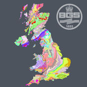
iGeology - Interactive geological mapping of the UK.iGeology is for anyone who wants to explore their local geology, at street-level scale, virtually anywhere in the UK.Amateur geologists, walkers and gardeners can look at whats in their local area, to find out about the rocks at the surface (superficial deposits) or the bedrock beneath. Search on place names or the postcode where you live, then click on the map and reveal the rocks beneath your feet. Only 1:625 000 scale data is available for Northern Ireland.
-
rating 5.0
-
size 68.5 MB


